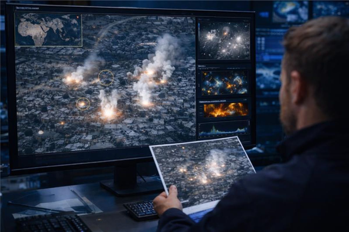
Over the past few years, the sky has quietly become a witness to war. It’s strange to think about, honestly. While journalists and human rights teams still risk their lives on the ground to document what’s happening, scientists have started looking at the same events from a very different vantage point—hundreds of miles above Earth. From orbit, of all places.
And here’s where things get tricky. One of the hardest things to detect from space is white phosphorus. This chemical is nasty stuff. It bursts into flames the moment it touches air. Instantly. The result is a very distinctive—and frankly terrifying—display of fire and smoke that investigators try to spot from satellite imagery.
In the UK, several research groups are digging into this challenge. Teams at organisations like Forensic Architecture, along with investigators from Human Rights Watch, are pushing the work forward. They rely heavily on satellite data. But the process isn’t just pure science. Not at all. It’s a strange blend of advanced physics, digital forensics, and a bit of old-fashioned detective work. The kind where you stare at clues until the picture starts to make sense.
The Visual Fingerprint: The ‘Octopus’ Effect
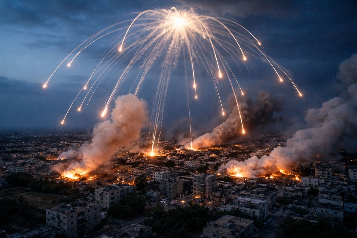
The fastest way scientists spot a white phosphorus strike is by looking for its visual pattern. Every weapon leaves a signature. White phosphorus is no exception. Unlike conventional explosives—which usually produce a single sharp blast—these munitions behave very differently.
They’re often fired as “air-burst” shells. That means the munition detonates before it even hits the ground. Right there in the air.
When that happens, dozens of felt wedges soaked in the chemical scatter outward. They ignite immediately. As they fall, they leave long white trails of smoke behind them. Seen from above, the pattern is oddly specific. A central burst. Then multiple lines stretching outward and downward. It almost looks like tentacles spreading out from the explosion.
Researchers sometimes call it the “octopus” pattern. Once you’ve seen it, it’s hard to unsee.
Table 1: Visual Differences in Munitions
| Feature | Conventional Explosive | White Phosphorus |
|---|---|---|
| Burst Pattern | Single, concentrated point | Multi-point spread. Often described as an “octopus” shape |
| Smoke Colour | Grey, black, or tan | Extremely bright and dense white smoke |
| Residue | Charred ground and visible craters | Scattered ground fires and star-like burn patterns |
| Duration | Almost instantaneous | Burning that can continue for several minutes |
Beyond the Visible: Multi-Spectral Analysis
Of course, clear photos help a lot. No surprise there. But modern satellites can see far more than what the human eye picks up. Systems such as the European Space Agency’s Sentinel-2 satellites, or commercial imaging systems from Maxar, capture data across multiple wavelengths of light.
Scientists call this “multi-spectral analysis.” Sounds technical—and it is—but the idea is simple enough. Instead of just visible light, analysts examine infrared bands. Near-Infrared (NIR). Short-Wave Infrared (SWIR). Light we simply can’t see with our eyes.
And sometimes, oddly enough, those invisible signals tell the real story.
1. Thermal Anomalies
White phosphorus burns extremely hot. Temperatures can exceed 800°C. That’s far hotter than most building fires. Hotter than many standard battlefield explosions too.
Satellites equipped with thermal sensors can detect these bursts of heat. They appear as intense “hotspots.” Sometimes they persist for several minutes. If analysts notice a cluster of unusually hot signatures inside a residential neighborhood, alarms go off—figuratively speaking. It’s a major red flag. Investigators start paying very close attention.
2. The Smoke Signature
The smoke from white phosphorus isn’t ordinary smoke. Chemically speaking, it contains phosphorus pentoxide. That matters because the compound reflects and absorbs light in very particular ways.
Scientists sometimes refer to this as a “spectral footprint.” Think of it like a fingerprint, but made of light instead of ridges. By analyzing how the smoke interacts with certain wavelengths, researchers can often separate it from the smoke of burning buildings, vehicles, or even smoke grenades.
It’s not always obvious at first glance. But the data tends to give it away.
Verifying the “Aftermath”
Once the flames fade and the smoke clears, the investigation keeps going. In fact, that’s when another layer of evidence appears. Scientists start looking for the scars left behind.
-
Agricultural Impact: White phosphorus is brutal on soil and vegetation. Fields can be damaged almost instantly. Satellite systems track vegetation health using something called the Normalised Difference Vegetation Index, or NDVI. If a bright green field suddenly shows a dramatic drop in plant health right after a reported strike, investigators take notice. That sudden loss of “greenness” usually signals chemical damage.
-
Persistent Hotspots: White phosphorus behaves unpredictably. It can reignite if fragments are disturbed and exposed to oxygen again. Because of this, satellites sometimes detect flickering thermal signals at the same location for several days. That repeated heat signature is another clue.
-
UK Perspective: Researchers led by Dr. Eyal Weizman at Forensic Architecture in London have pushed these techniques even further. Their team builds detailed 3D models of attacks. They combine satellite imagery with mobile-phone videos recorded on the ground. Then they synchronise the timelines. When everything lines up, investigators can estimate exactly where the shell burst and how the burning fragments spread through the air.
Also Read: Humanitarian Crisis in the Middle East: Civilians Caught in Iran-USA War Crossfire
Challenges and Limitations
Now, to be fair, identifying white phosphorus from roughly 400 miles above Earth isn’t always straightforward. Not even close. There are several obstacles that make the job harder than it sounds.
-
Cloud Cover: Clouds block optical satellites. Simple as that. Regions like the UK—or many conflict zones, for that matter—often sit under thick cloud layers for days.
-
Resolution: Military satellites can capture incredibly detailed imagery. Public satellite data, however, is often less precise. Scientists sometimes have to wait for the perfect image pass before drawing conclusions.
-
Timing: Satellites don’t hover over one location forever. They pass overhead on scheduled orbits. A white phosphorus burst might last only a few minutes. If a satellite arrives an hour later, the smoke may already be gone.
The Goal: Accountability
So why put so much effort into tracking this at all? Good question. The answer lies in international law.
Technically, white phosphorus itself is not completely banned. But using it as an incendiary weapon in civilian areas can qualify as a war crime. That distinction matters a lot.
Satellite analysis offers something investigators desperately need—an independent perspective. An eye in the sky that can’t be intimidated, pressured, or silenced. When evidence comes from orbit, it carries weight. It can support legal cases. It can trigger international scrutiny. And in the chaos of war, that kind of truth matters.
RECENT CASE STUDIES
Proving violations of international law takes more than suspicion. Or even eyewitness accounts. What investigators really need is solid data—clear, verifiable evidence.
Over the last few years, several major conflicts have pushed satellite analysis into the spotlight. Researchers and human-rights investigators have used orbital imagery to verify the use of white phosphorus almost in real time. It’s pretty remarkable when you think about it.
Here are a few examples from 2023 through 2026 that show how these techniques actually play out in the real world.
1. Southern Lebanon: Yohmor and Border Villages (2024–2026)
One of the most recent and heavily documented cases occurred along the Lebanon–Israel border. Several villages in the region reported incendiary strikes.
In March 2026, investigators from Human Rights Watch confirmed a series of attacks in the town of Yohmor.
To verify the claims, analysts combined geolocated social-media footage with high-resolution satellite imagery. The timing was crucial. By matching the timestamp of a video with the satellite’s orbital position, researchers could cross-check what appeared in both records.
And there it was—the tell-tale “octopus” pattern of smoke trails associated with M825 155mm artillery shells.
Table 2: 2024–2026 Lebanon Verification Data
| Location | Date of Incident | Primary Evidence | Satellite Source |
|---|---|---|---|
| Yohmor | March 2026 | Multi-spectral imaging | Sentinel-2 / Maxar |
| Dhayra | Oct 2023–2024 | Thermal hotspots | Sentinel-2 |
| Aita al-Shaab | May 2024 | NDVI vegetation loss | Planet Labs |
Interestingly, researchers noticed something else. The chemical didn’t just spark immediate fires. It left lingering traces in the soil. Those signatures showed up in infrared satellite bands for weeks after the attack.
2. Gaza City and the Port Area (October 2023)
During the early days of the Gaza conflict in October 2023, Amnesty International’s Crisis Evidence Lab investigated reports of white phosphorus near the Gaza harbour.
Urban areas make this kind of analysis difficult. Buildings block views. Smoke mixes with other fires. Still, investigators managed to piece together the evidence.
Satellite images revealed possible launch positions for M109 155mm howitzers across the border. Analysts calculated the artillery trajectories. Then they compared those paths with the white plumes visible above the port area.
The overlap was difficult to ignore. The data strongly suggested incendiary munitions had been used in a densely populated civilian zone.
3. Ukraine: The Battle for the Donbas (2022–2024)
In Ukraine, the possible use of white phosphorus—or similar incendiary materials such as thermite—has come up repeatedly during investigations.
The problem is access. Frontline areas in the Donbas are often too dangerous for journalists or independent observers. Satellite imagery becomes one of the only reliable ways to confirm what actually happened.
Researchers at Forensic Architecture developed an unusual method called shadow analysis. It sounds simple. But the math behind it is pretty clever.
By studying the shadows cast by falling incendiary fragments in satellite images, investigators can estimate the altitude where the shell burst in the air.
That detail matters more than you might expect. A higher burst spreads the burning fragments across a wider area. And that increases the danger to civilians—something investigators must consider when assessing whether a potential war crime occurred.
Key Stats: Satellite Impact
-
Verification Speed: Back in 2022, verifying a strike could take weeks. Analysts had to sift through data manually. By 2026, things have sped up dramatically. AI-assisted satellite systems can flag suspicious thermal anomalies within roughly 6 to 12 hours.
-
Detection Accuracy: According to researchers, multi-spectral analysis can now distinguish white phosphorus smoke from standard smoke with about a 94% accuracy rate. Not perfect—but impressively close.
Conclusion: The Sky is Watching
In a way, the rise of satellite evidence has changed how international justice works. Years ago, investigations depended mostly on testimony from people on the ground. Those voices still matter enormously. But now there’s another layer of proof.
Orbital sensors can detect the heat of a burn. They can track smoke patterns. They can even reveal chemical damage etched into the land.
It’s a strange thought, honestly. From hundreds of miles above Earth, satellites are quietly documenting events that once disappeared into the fog of war. And little by little, that fog is starting to thin.
Sources & References
- Human Rights Watch. (2026, March). Lebanon: Evidence of white phosphorus use in Yohmor and border villages. Human Rights Watch Investigations.
- Forensic Architecture. (2026). Satellite and shadow analysis in conflict zones: Advancing verification of incendiary munitions. Goldsmiths, University of London.
- Amnesty International. (2023, October). Gaza: Crisis Evidence Lab confirms suspected white phosphorus use in port area.
- Planet Labs. (2024, May). Vegetation health monitoring in conflict zones: NDVI analysis of Aita al‑Shaab. Planet Labs Research.
- European Space Agency. (2022). Sentinel‑2 multi‑spectral applications in conflict monitoring. ESA Earth Observation Reports.
Disclaimer: This article is intended solely for informational and educational purposes. It summarizes publicly available research and investigative methods related to satellite imagery and conflict analysis. The content does not promote, endorse, or support any weapon, military activity, or political position. Readers should use the information responsibly and refer to official sources for verified reports and legal interpretations.